| WA8LMF Home Page | Main Ham Radio Page |Main UI-View Notes Page | Updated 4 January 2011 |
Precision Mapping is normally considered to be of use only to UIview users located in the US and Canada --BUT-- the latest version of Precision Mapping (Ver 9.0) can now accept external vector (i.e. zoomable, scalable) map data as overlays on it's base map for anywhere in the world.
Precision Mapping imports the formats of the two leading professional GIS (Geographic Information Systems): ArcView's .SHP file format and MapInfo's .MIF format. Both programs are widely used around the world by government surveyors, public safety authorities, agricultural planners, environmental groups, tax assessors, transportation managers, oil & gas companies, weather agencies, etc. (ARCview-format shape files for the US National Weather Service warning zones are already used by the Uiview UI-NWS feature. Click Here for more details on this.)
These vector imags can be loaded into UIview on top of the Precision Mapping 9.0 world-wide basic outline map. These are are NOT static bitmaps; they are fully scrollable, zoomable vector images just like Microsoft MapPoint (or Precision Mapping in North America). There are many sources on the web for compatible vector files. The screen shots below show ArcView shape files downloaded from
http://www.mapcruzin.com/free-world-country-city-place-shapefiles.htm
These are vector databases in ArcView format extracted from the Open Street Maps database at:
(Normally one views Open Street Maps online in a web browser. The MapCruzin files are this same data captured for off-line use by other programs.)
Note that the vector data a) is "rubber"; i.e. can be "stretched" or "squeezed" to any scale while remaining clear, and b) has a transparent background between the lines. As a result, one can have a fixed bitmap image (i.e. topo map scan or Google satellite photo) under-laid BELOW the vector line road data, if desired. (The bitmap image would become severely pixellated as you zoom in, but the road data would remain sharp.)
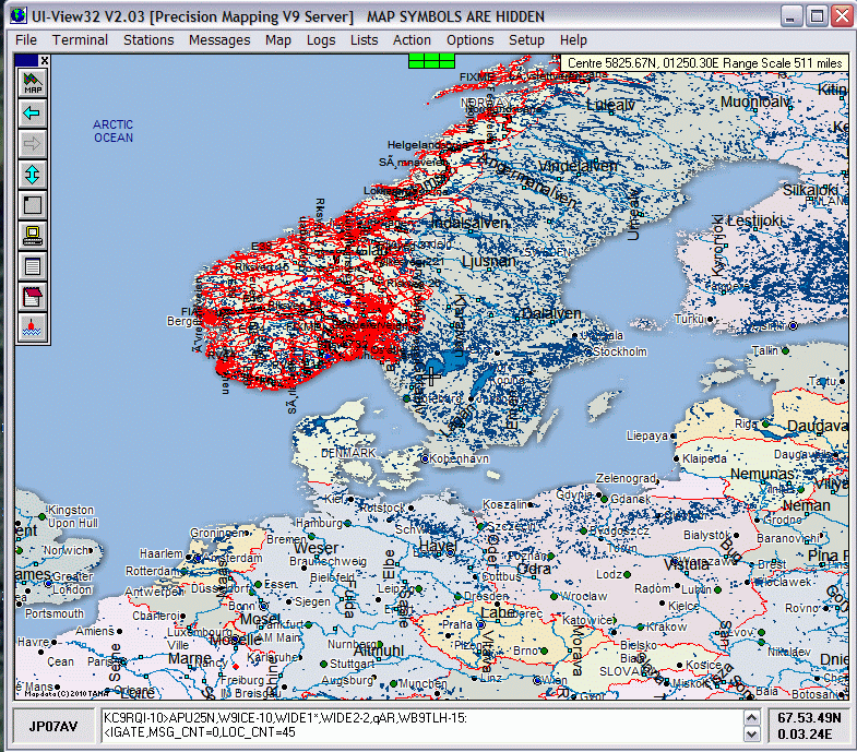
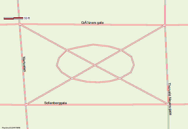
UIview with Precision Mapping 9.0 showing vector data overlay for Norway
downloaded from
http://www.mapcruzin.com/free-norway-arcgis-maps-shapefiles.htm
.
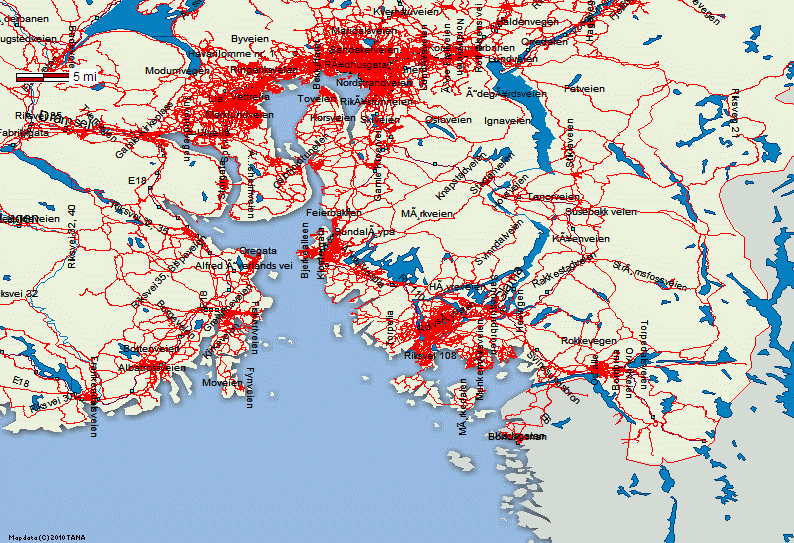
Same image zoomed into 5mile (8KM) range scale
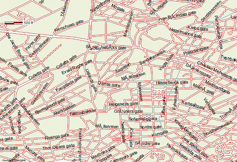
Same Image Zoomed Into 500 Foot (Approx 150 meter) Scale
Same Image Zoomed Into 200 Foot (Approx 60 Meters) Scale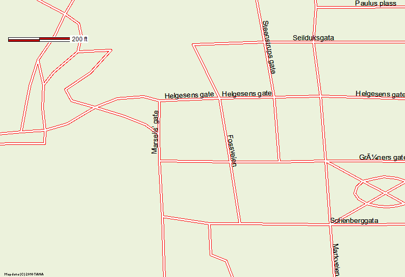
Same Image Zoomed Into 50 Foot (Approx 15 Meters) Scale
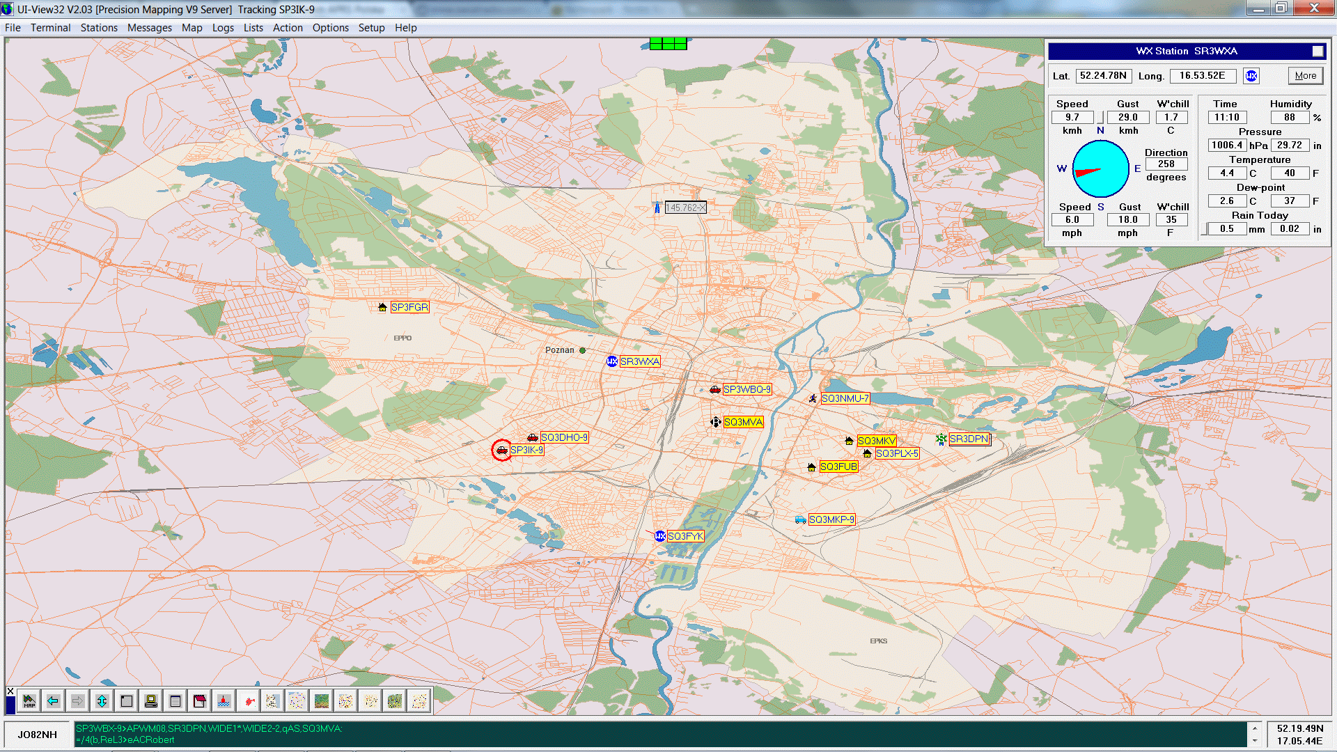
From the same source, here is a multi-layer download
covering an area in Poland. Here there are stacked layers of roads,
bodies of water, natural areas & parks, railroads and some more. Edited to
appear in different colors and to be visible at different zoom steps.
(Courtesy of SP3LYR/AB9FX)