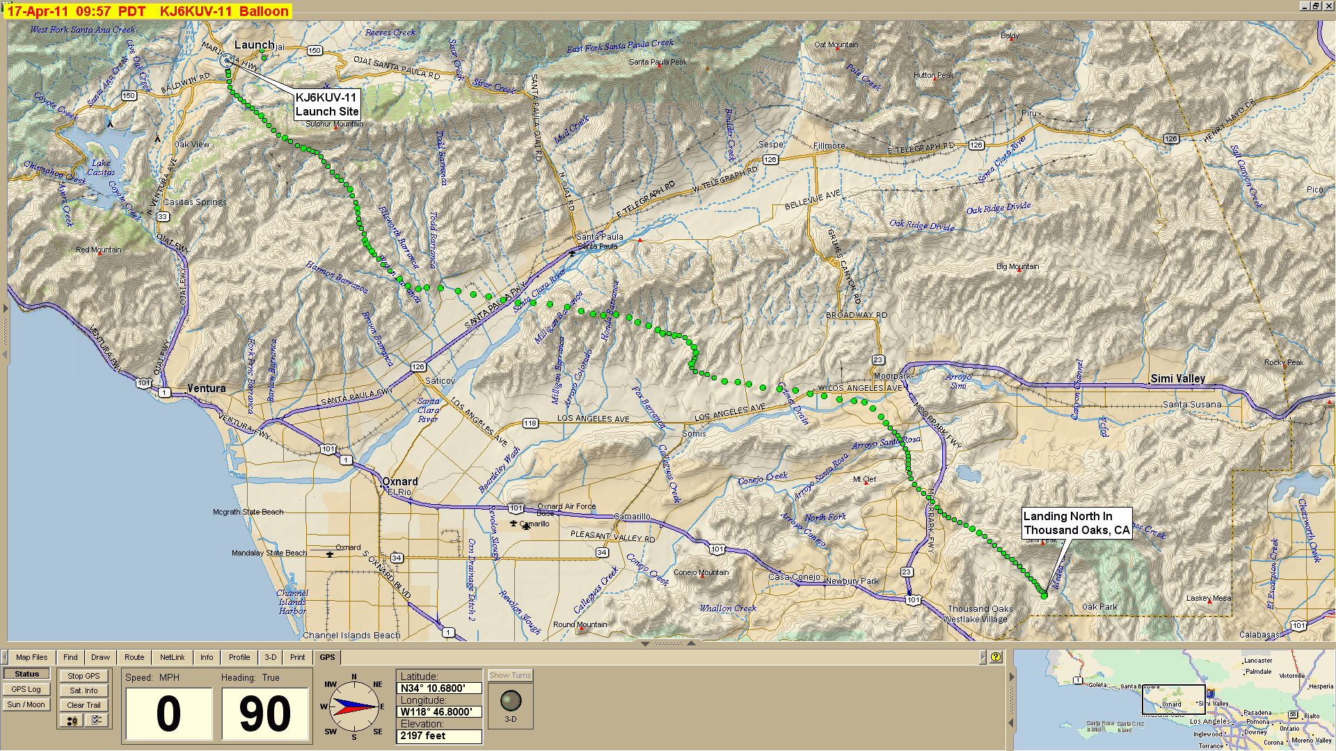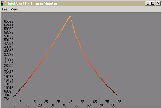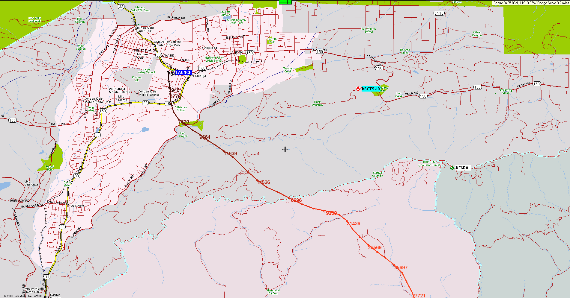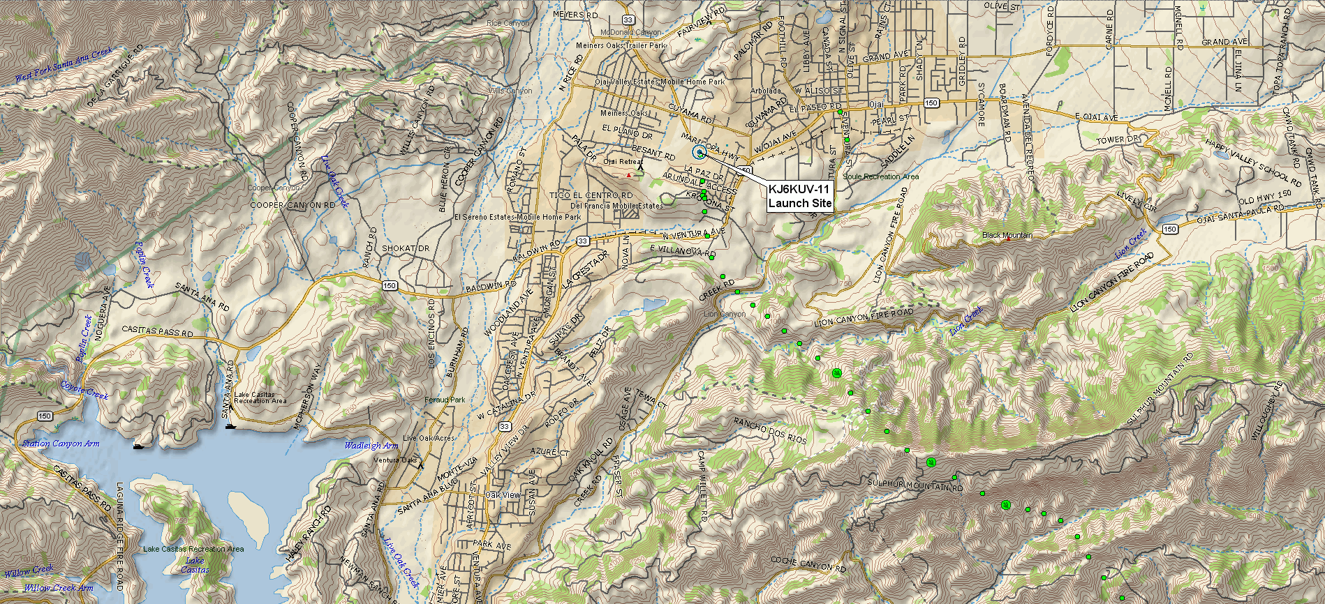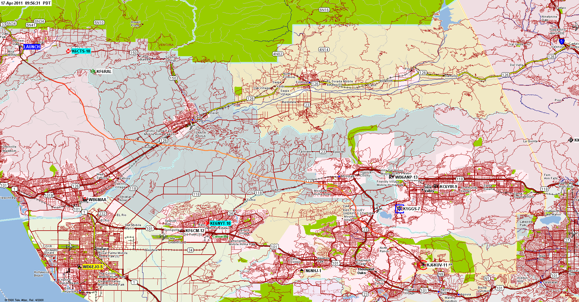
Flight CompletedKJ6KUV-11 Balloon FlightLaunch from Ojai CaliforniaSunday 17 April 20118:00 AM Local (PDT)1500 UTC |
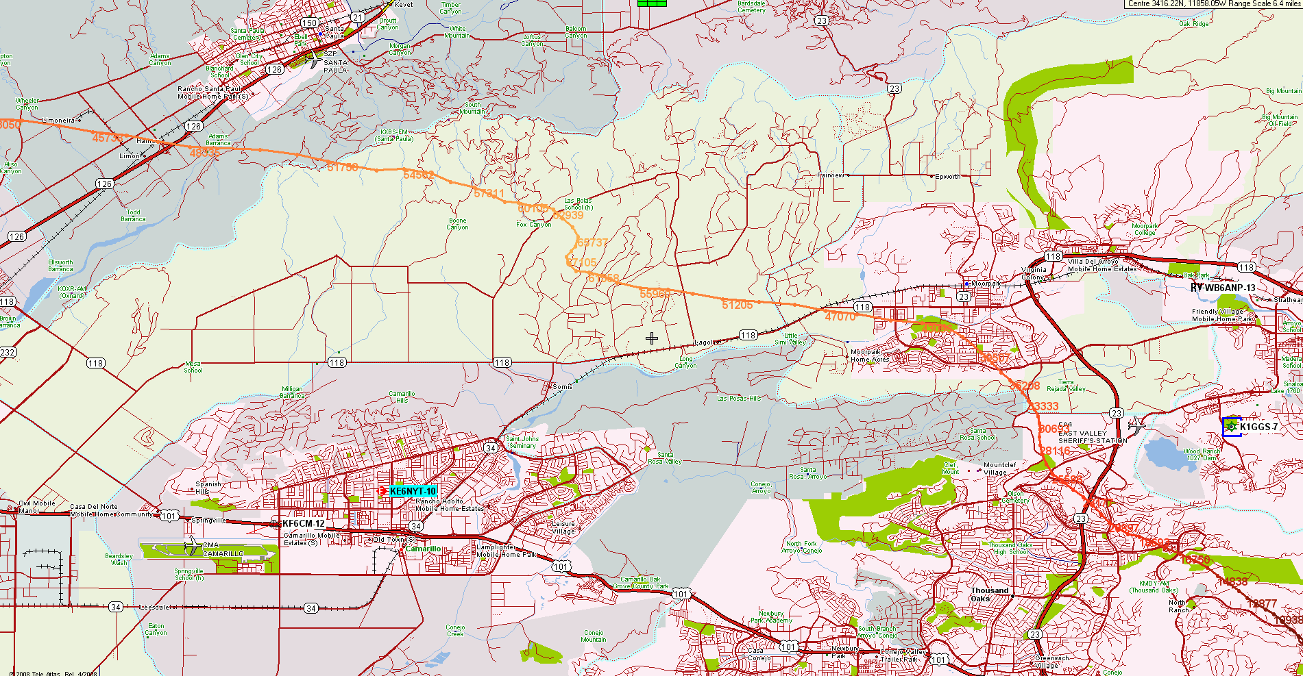
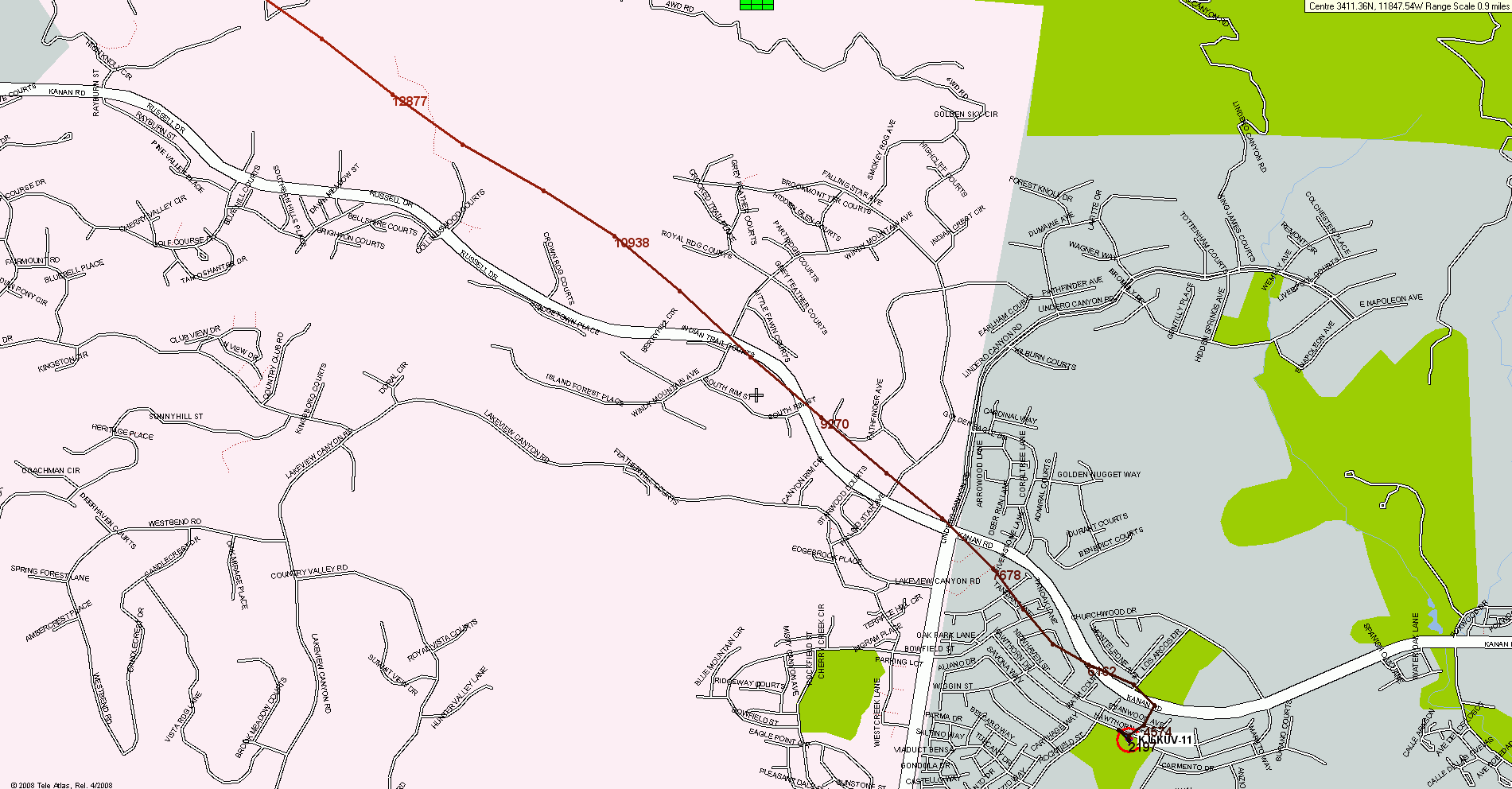
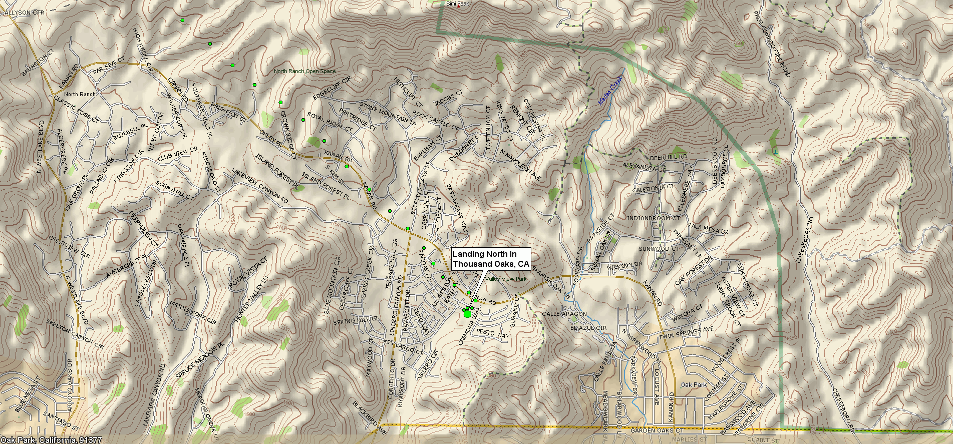
These are large (1920 x 1080 Full HD) screen captures from UIview and Delorme's TopoUSA 8.0. Many browsers will try to downsize these images to fit your screen, making the map details and labels an illegible blur, if your computer's display is less than 1920 x 1080 HD resolution.
Most modern browers can be toggled to display the image full size by clicking in the image area, or by choosing an image resize option from a pull-down menu. You will then get a clear display, but only part of the map will show. Scroll down and to the right to see all areas of both maps.