WA8LMF.net LiveTrack
System
K6RPT-8 High Altitude Balloon (Flight
Completed)
Friday 11 March 2011 Launch 7:30 AM PST
(1530 UTC)
|
These are large (1920 x 1080 Full HD) screen captures from UIview and Delorme's
TopoUSA 8.0. Many browsers will try to downsize these images to
fit your screen, making the map details and labels an illegible blur,
if your computer's display is less than 1920 x 1080 HD
resolution.
Most modern
browers can be toggled to display the image full size by clicking in
the image area, or by choosing an image resize option from a pull-down
menu. You will then get a clear display, but only part of the
map will show. Scroll down and to the right to see all areas of both maps.
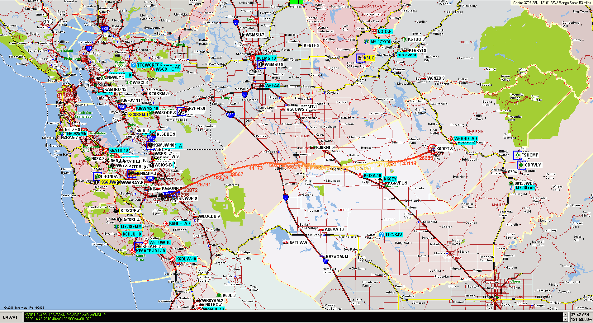
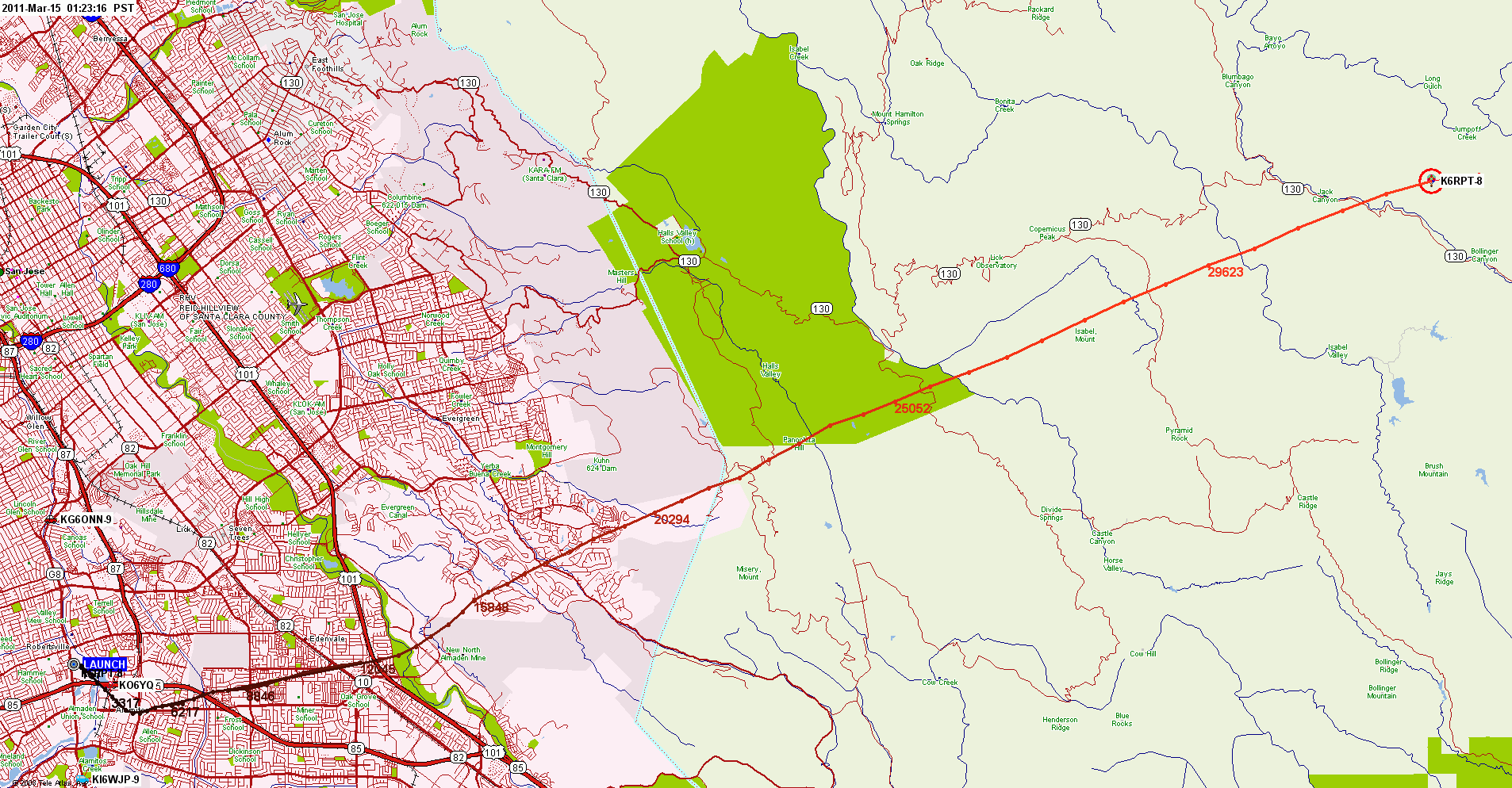
UI-View & Precision
Mapping 8.1
Scroll down for Topo
map displays.
Track of Entire Flight - Landed About 10:50 AM 11 March 2011
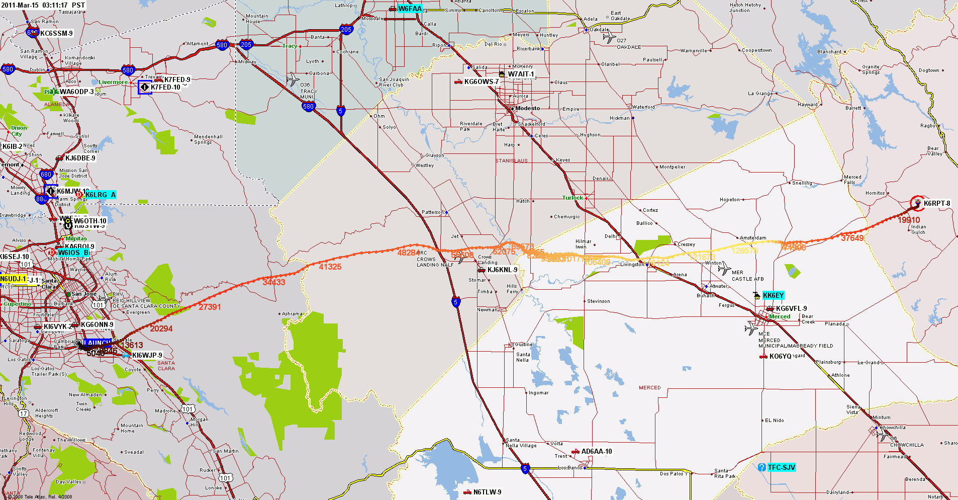
Alternate Larger-Area Display
Note large amount of APRS activity in greater Northern California
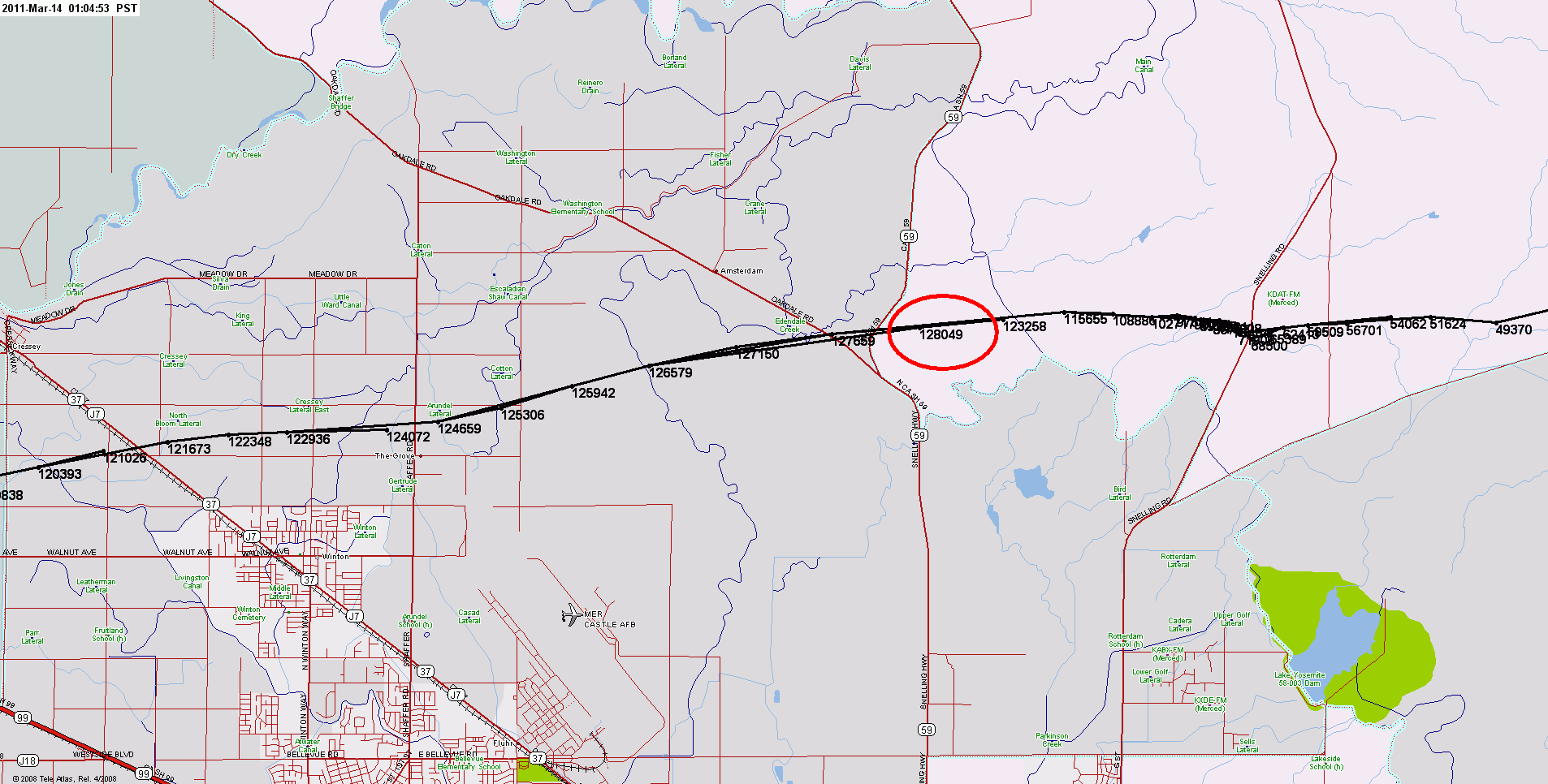
Close-Up View of Track At Launch
Track As of 9:03 AM (First Half-Hour of Flight)
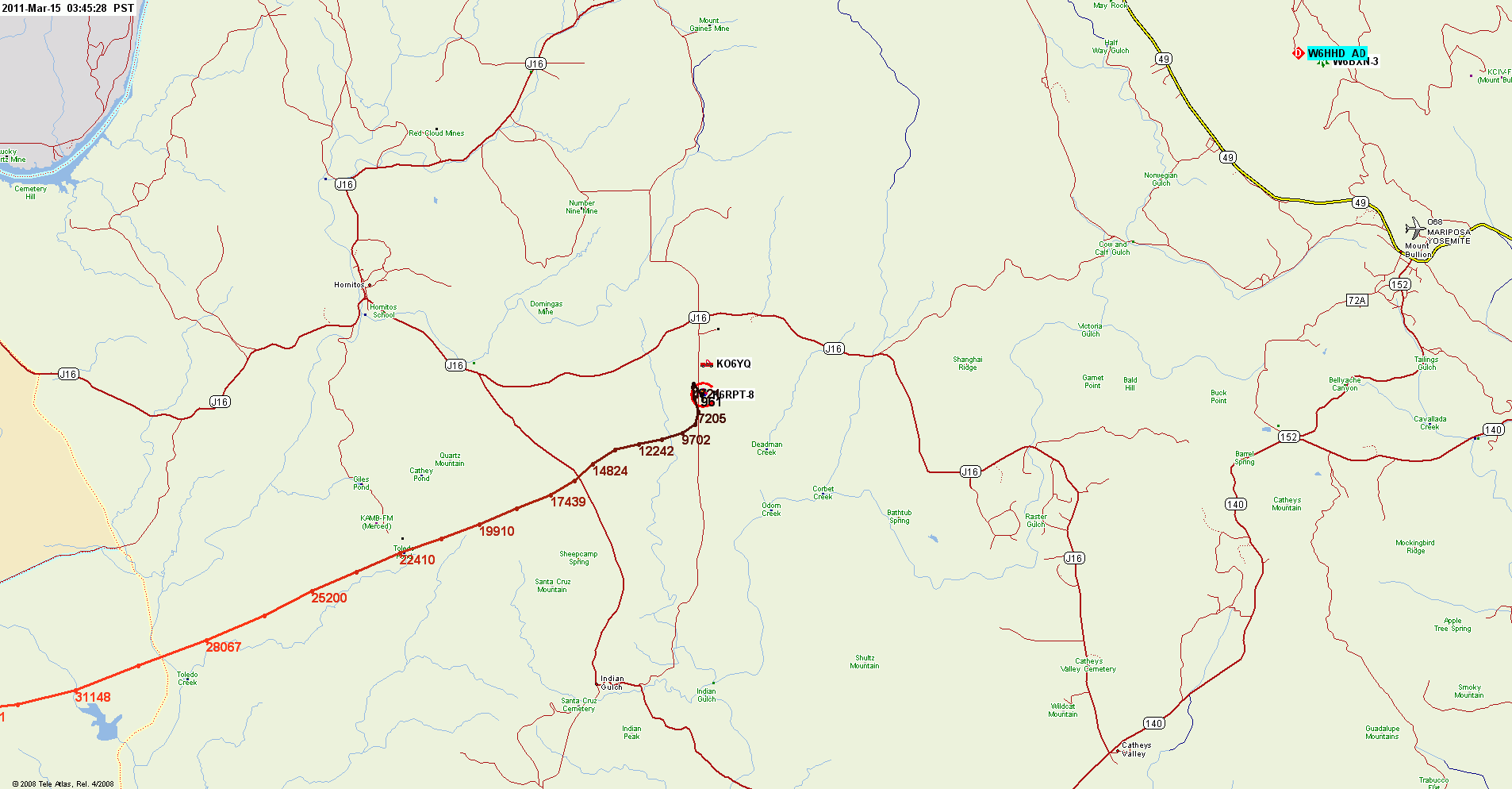
Close-Up Detail - Maximum Altitude
Track Set To Black Instead of Default Color For Better Legibility
Landing & Recovery -- Landed Conveniently Near Road but 35 Feet
Up In A Tree!
RT 140 (lower right corner of map) is one of three main entrance
routes to Yosemite National Park
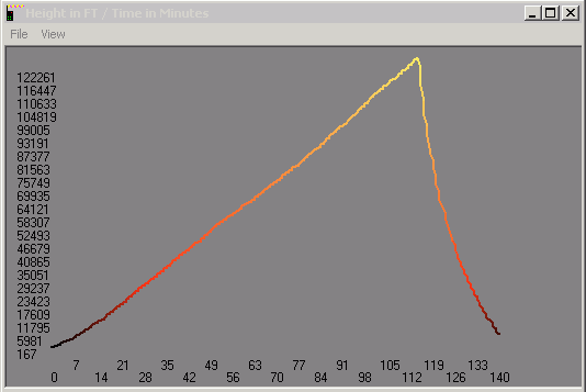
UI-HeightTrack Profile
Altitude vs Minutes From Start
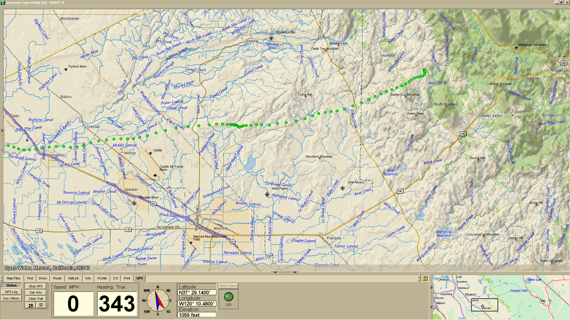
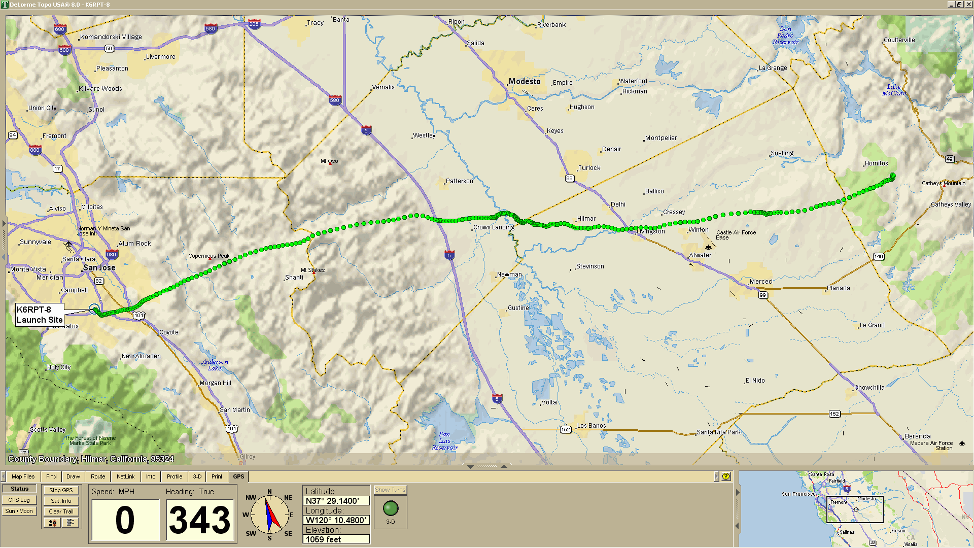
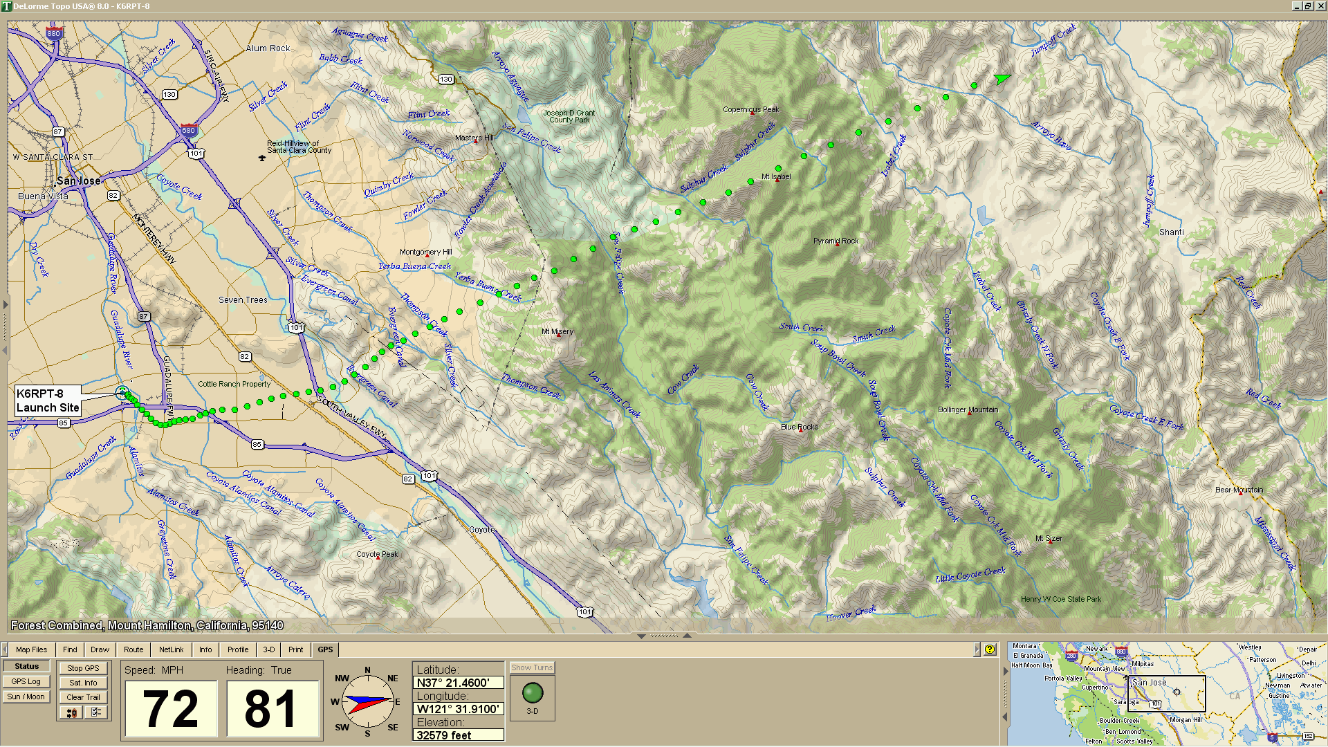
Delorme TopoUSA 8.0 Relief Maps
Complete Track as of End Of Flight at 10:50 AM
First 30 Minutes from Launch as of 9:03 AM
Landing Zone in Foothills of Sierra Nevadas
North-East of Merced, CA -- About 25 Miles
Southwest of Yosemite National Park