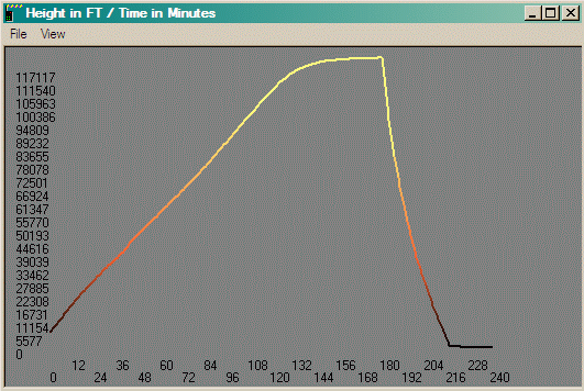
The flight was scheduled to lift off at 5:00 AM Pacific Daylight Time, but actually launched around 6:10 AM. Landing was about three and a half hours later. Note time interval on ground in profile below.
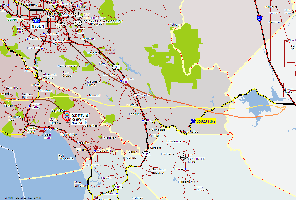
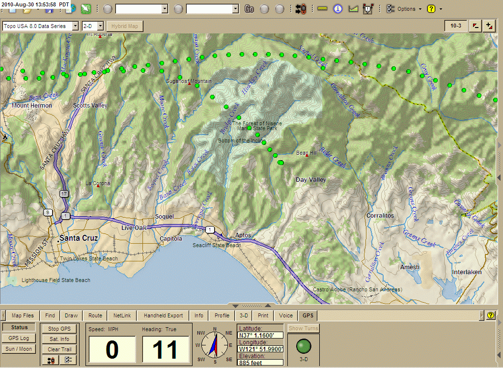
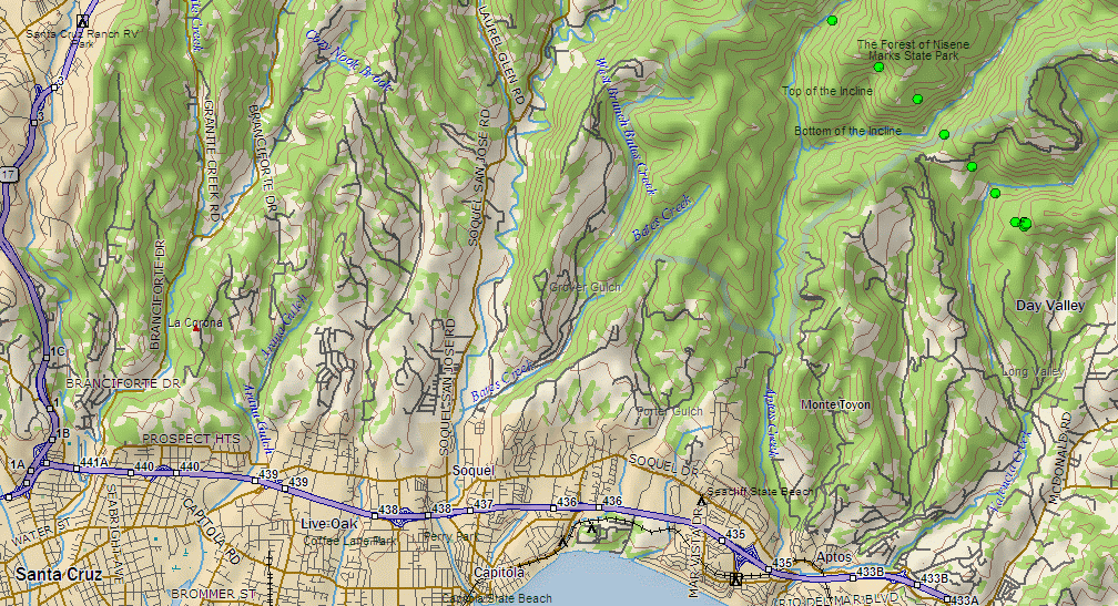
Scroll down for 3 maps below profile. These are large (1024 x 768 XGA) screen captures from UIview and Delorme's TopoUSA 8.0. Many browsers will try to downsize this image to fit your screen, making the map details and labels an illegible blur, if your computer's display is less than 1024x768 XGA resolution.
Most modern browers can be toggled to display the image full size by clicking in the image area, or by choosing an image resize option from a pull-down menu. You will then get a clear display, but only part of the map will show. Scroll down and to the right to see all areas of the map.
Generated by UI-View and UI-Height-Track Plug-In