California Near Space Project
Launch
CNSP-11 & CNSP-12
Long-Duration Stratospheric Floaters
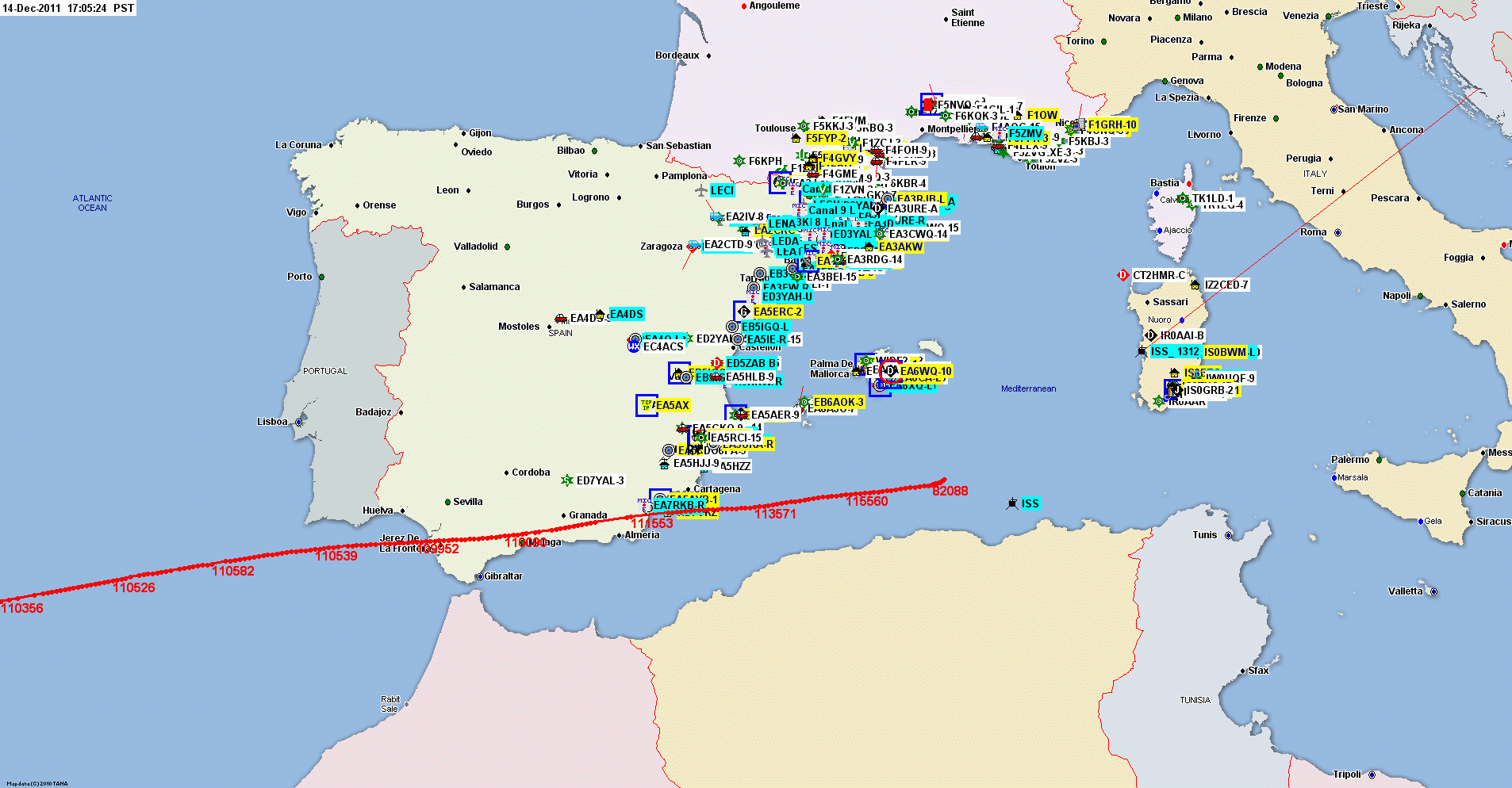
CNSP-11 WORLD RECORD Ham Balloon Flight Landed In Mediterranean
Sea After A Two-Day 6,236-Mile Flight Across the Atlantic!
CNSP-11, launched at 16:43 Pacific Time 12 December 2011, crossed the
entire continental US and left the U.S. mainland headed out over the
Atlantic about 0330 UTC Tuesday. Radio contact was lost about 400 miles
off the New Jersey coast. At that point it was still transmitting and
reporting normal battery voltage, holding altitude around 107,000 ft,
and headed toward the Straights of Gibraltar at about 150 MPH (240
KM/h).
Stations in the Azores started receiving it again mid-afternoon US EST
(early evening UTC) Tuesday.
K6RPT-11 reached mainland Europe at about 00:39 EST (0539 UTC) Wednesday
14 December 2011. It made landfall on the southern Atlantic coast of Spain near
Jerez De LaFrontera, Spain. It crossed over Spain into the Mediterranean
Sea,
and finally burst and was lost in the ocean off the coast of Libya
around 09:46 UTC 14 December 2011.
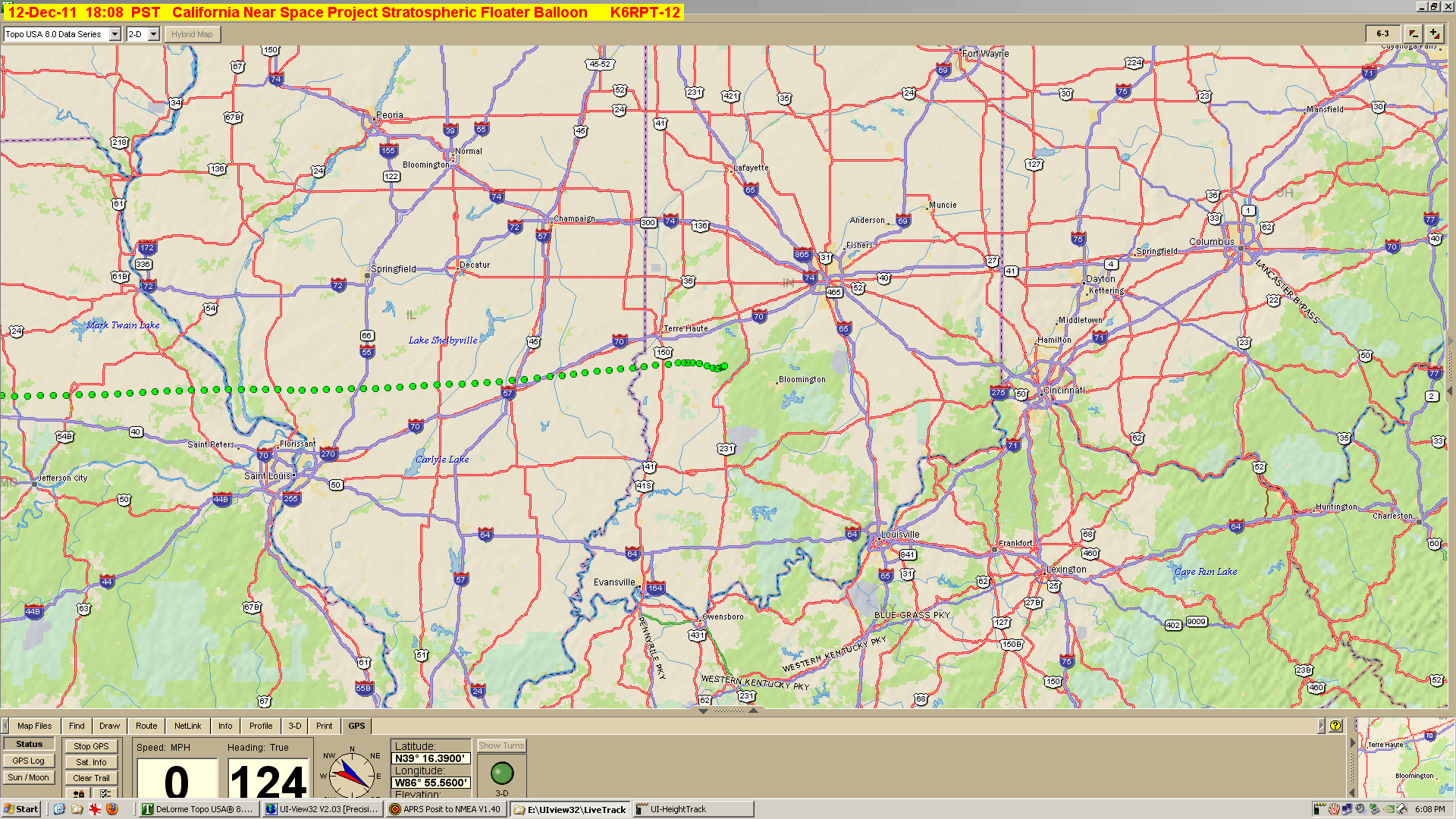
CNSP-12 Flight Over - Landed near Indianapolis, Indiana
CNSP-13 & CNSP-14
High Altitude/Short Duration (Both landed in western
Nevada)
First Launch Around:
4:00
PM Sunday Local (Pacific Standard Time)
0000 UTC
Monday 12 December
|