WA8LMF.net LiveTrack
System Balloon Flights
California Near Space Project
CNSP-15 (K6RPT-10)
Launched Around:
7:30 AM Local (Pacific Standard Time) 10 Feb 2012
15:30 UTC
Friday 10 Feb 2012
Flight Ended about 10:00 AM PST (18:00 UTC) 10 Feb
2012
|
Actual
time and date of each map capture is in upper-left corner of each
image.
These are large (1920 x 1080 Full HD) screen captures from UIview and Delorme's
TopoUSA 8.0. Many browsers will try to downsize these images to
fit your screen, making the map details and labels an illegible blur,
if your computer's display is less than 1920 x 1080 HD
resolution.
Most modern
browers can be toggled to display the image full size by clicking in
the image area, or by choosing an image resize option from a pull-down
menu. You will then get a clear display, but only part of the
map will show. Scroll down and to the right to see all areas of maps.
Numerous Maps and Plots Below
UI-View & Precision Mapping 9.0
Scroll down for Topo
map display.
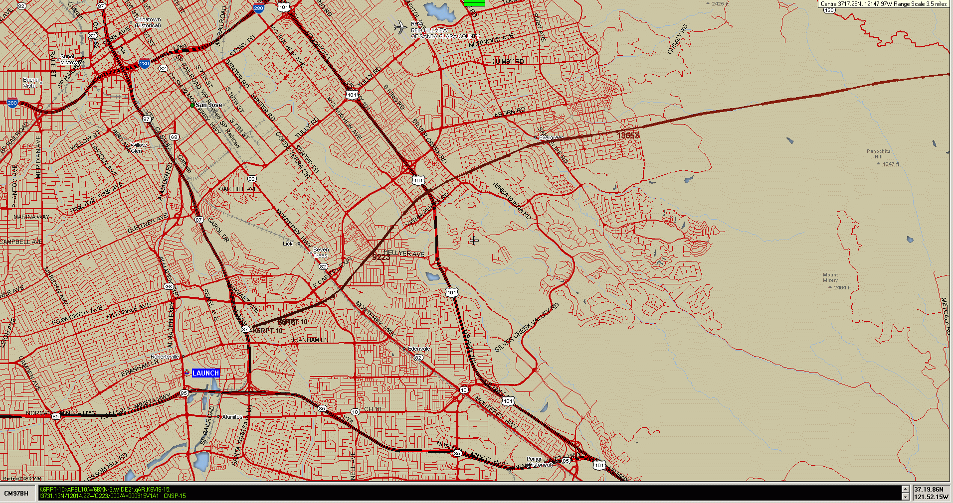
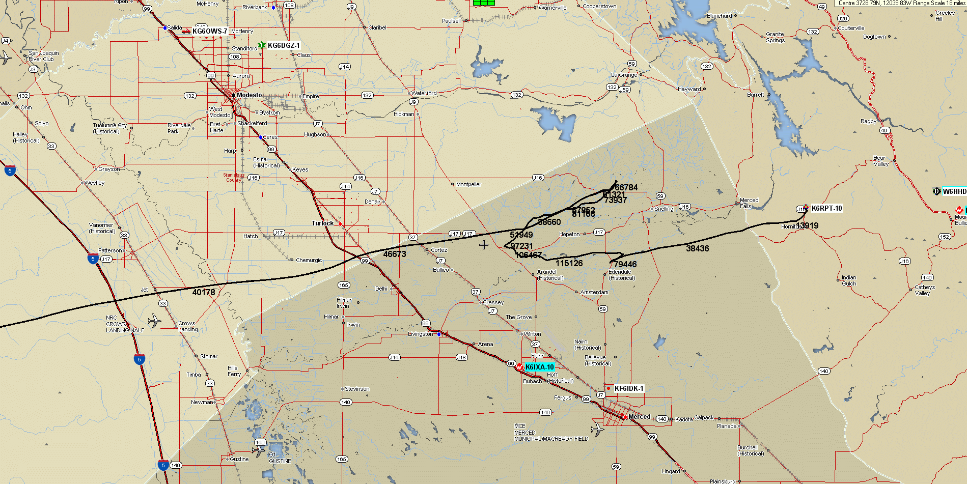
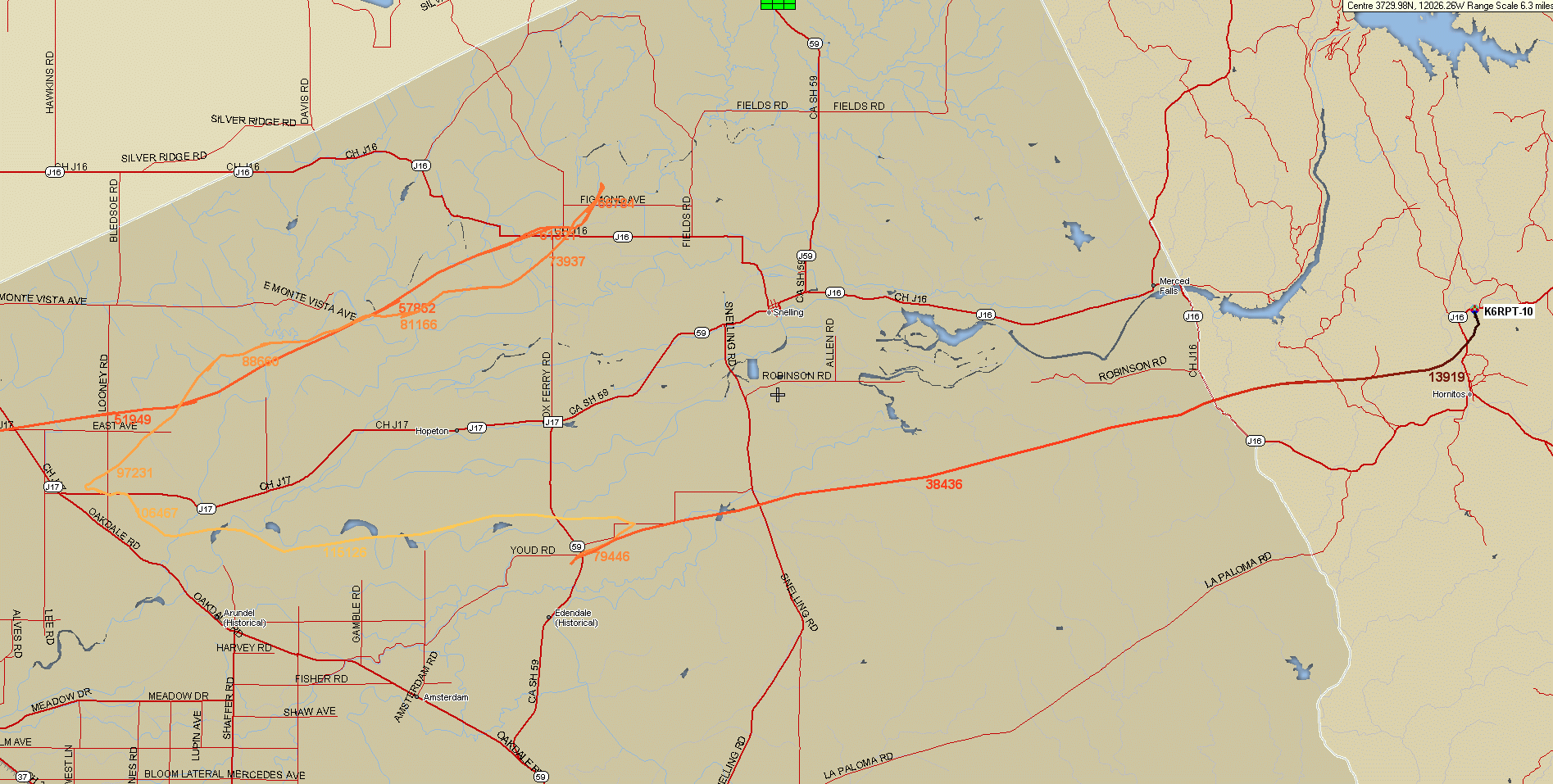
CNSP-15 (K6RPT-10)
Entire Flight
Entire Flight UIview/Precision
Mapping 9.0 Relief Display
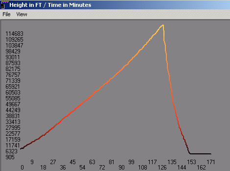
Vertical Flight Profile from
UI-Height-Track Plugin for UIview
Launch & Inital Ascent Detail on
UIview
Maximum Altitude & Landing on UIview
Maximum Altitude & Landing on UIview
(Color-coded)
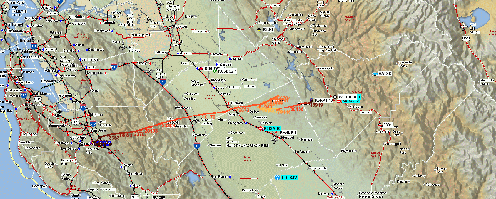
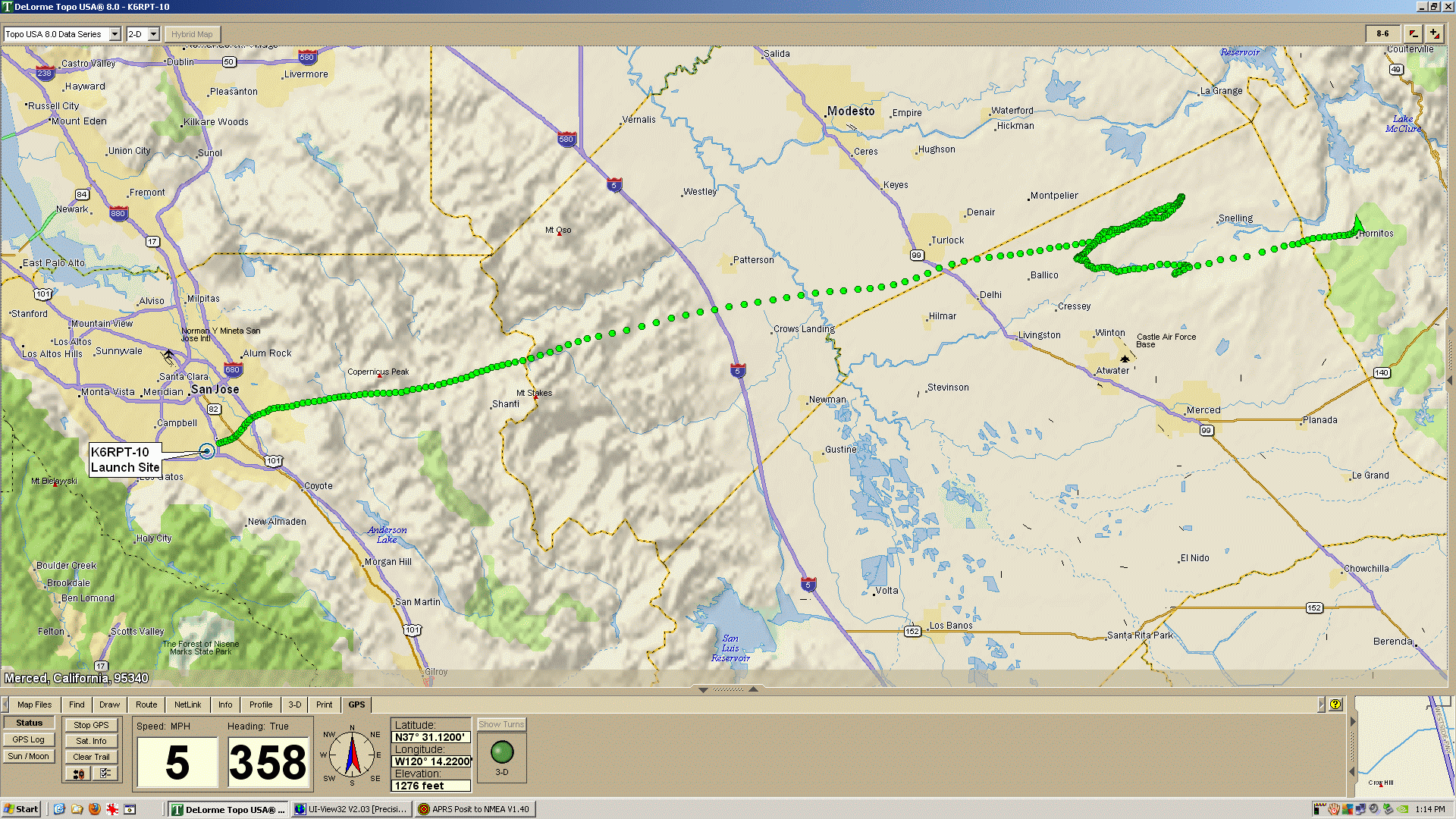
CNSP-15 (K6RPT-10) on Delorme TopoUSA 8.0
Total Flight on Topo USA
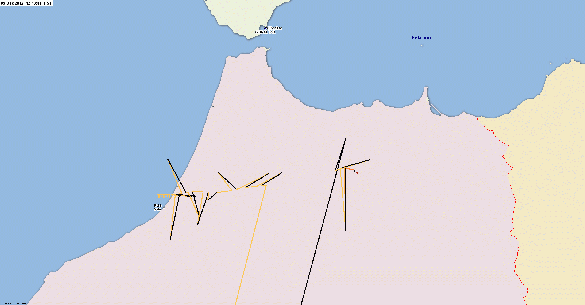
Landing Site Detail