Flight CompletedAE0SS-11 (EOSS163)
|
These are large (1920 x 1080 Full HD) screen captures from UIview and Delorme's TopoUSA 8.0. Many browsers will try to downsize these images to fit your screen, making the map details and labels an illegible blur, if your computer's display is less than 1920 x 1080 HD resolution.
Most modern browers can be toggled to display the image full size by clicking in the image area, or by choosing an image resize option from a pull-down menu. You will then get a clear display, but only part of the map will show. Scroll down and to the right to see all areas of both maps.
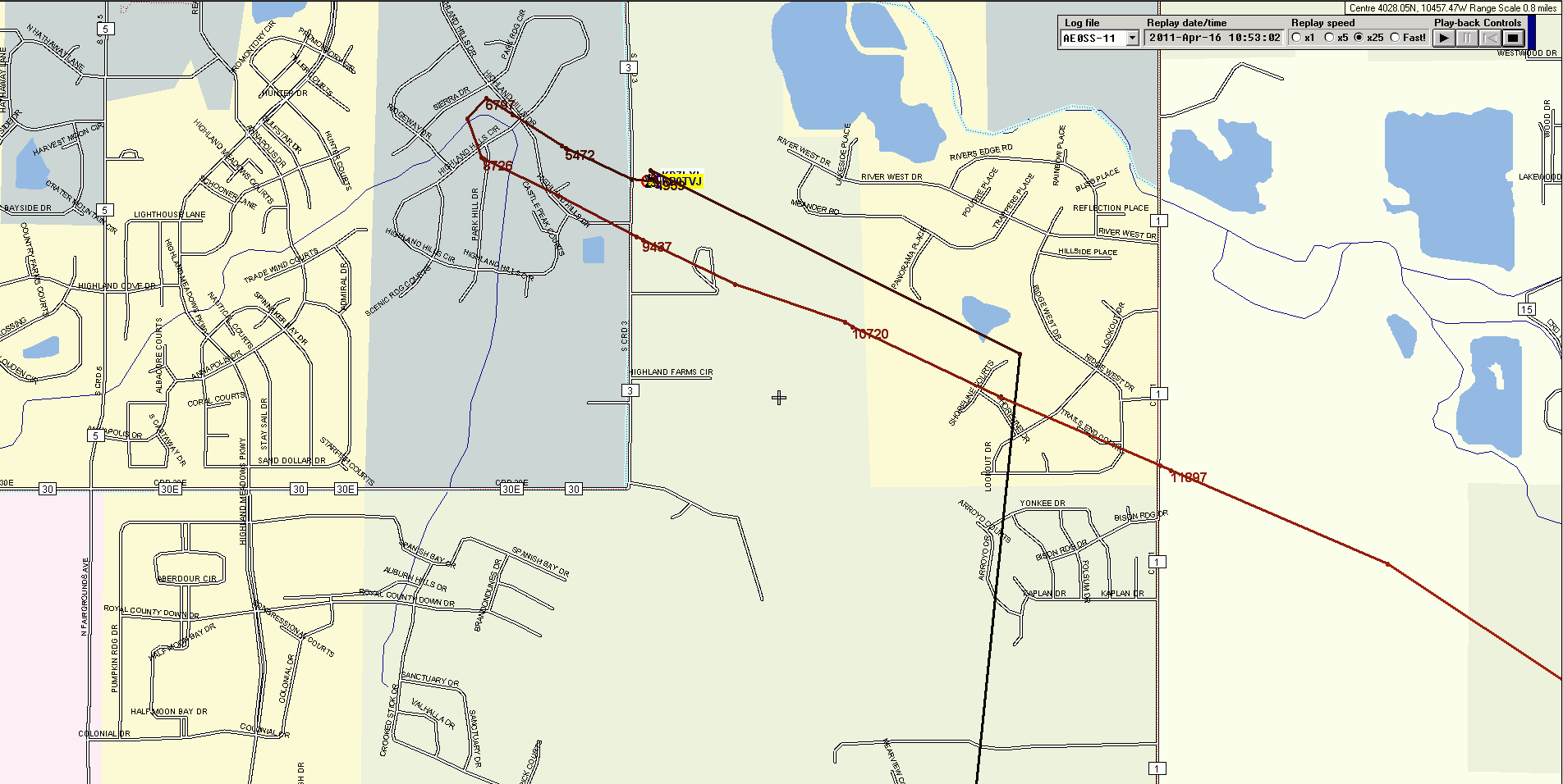
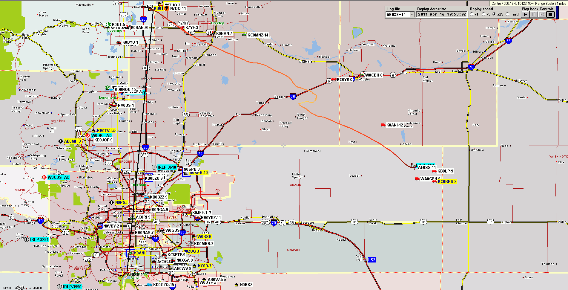
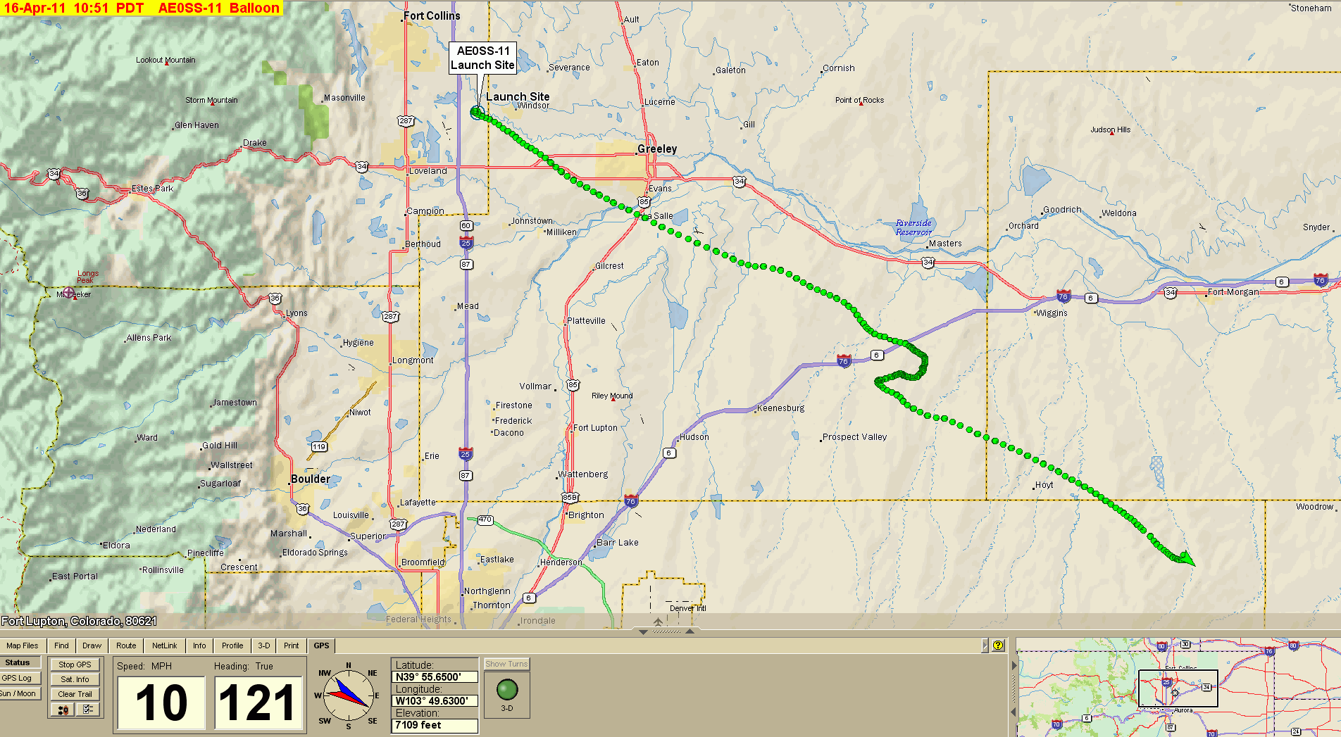
Note odd hiccup with AE0SS-11 showing start point on the south side of Denver metro area. I assume the GPS or TNC must have cached a previous position report that got transmitted when the unit was first fired up at the launch site. See detailed closeup of the launch for more detail.
Note bogus GPS fix on Denver southside abour 20 minues before launch,
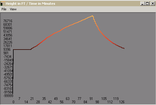
apparently before GPS achieved lock; i.e. "-100,000 feet" ???.
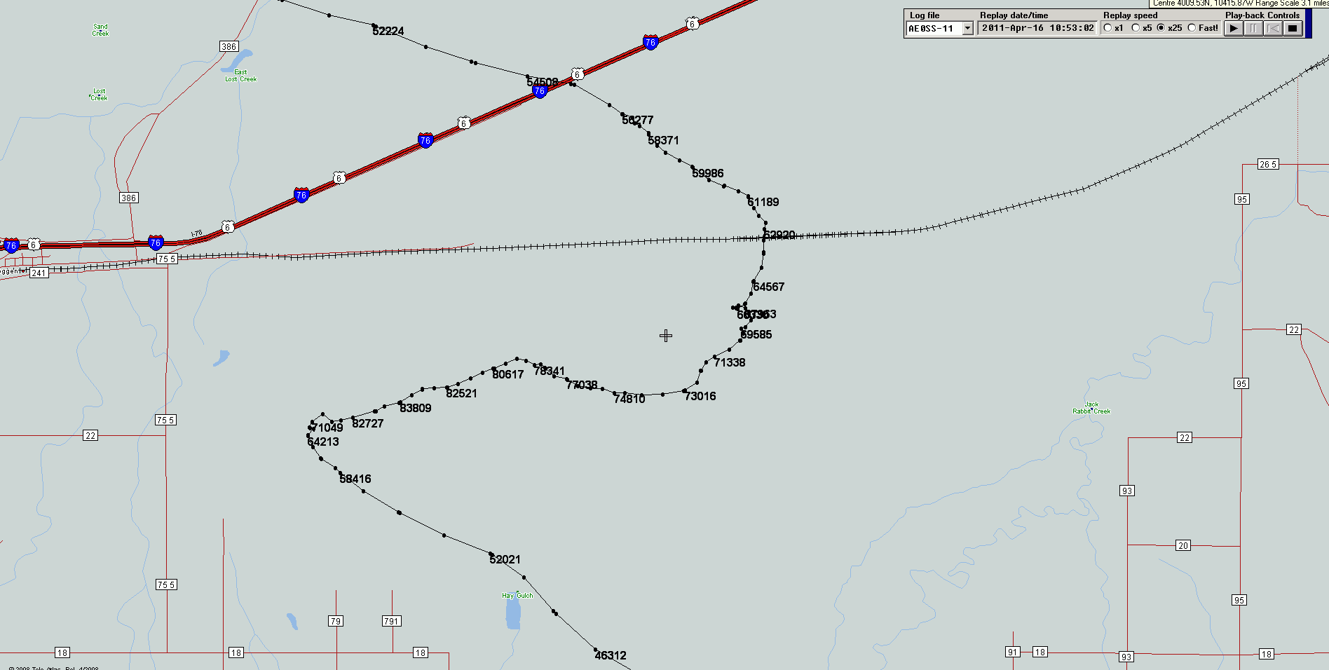
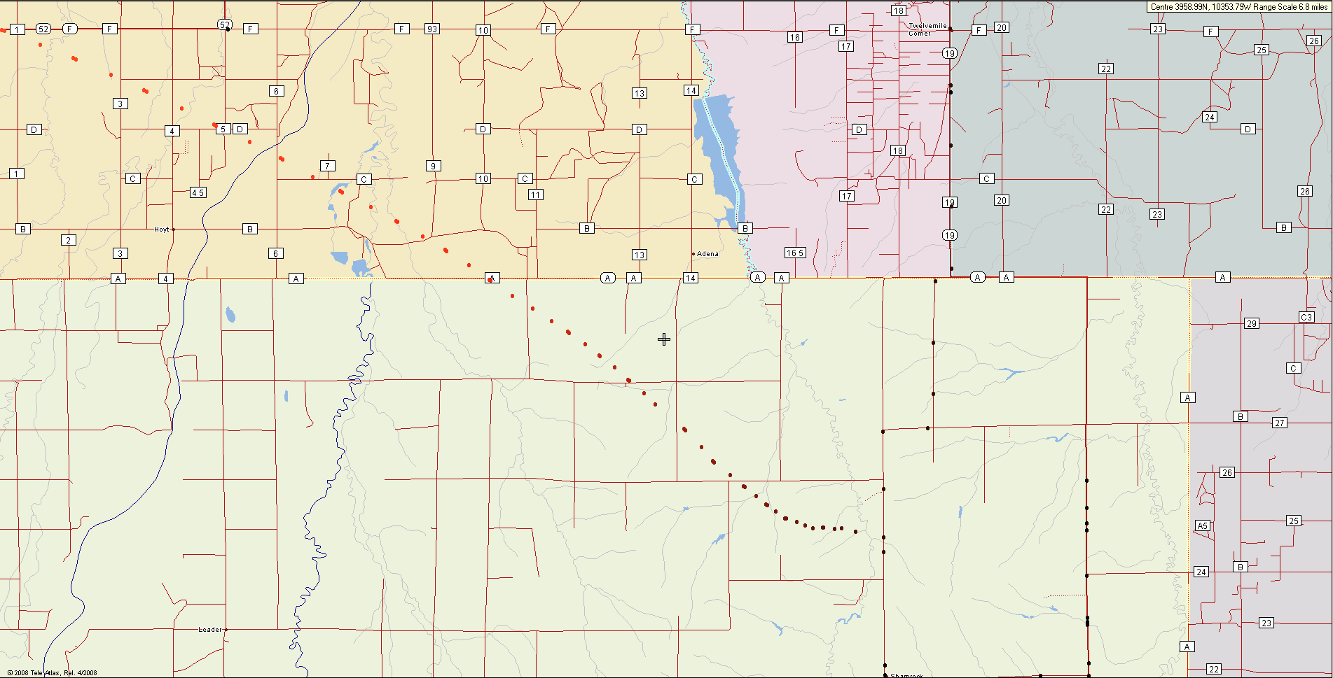
There appears to be a delayed-packet "hyper-jump" backwards in the
lower-right (red part of track) of this map.
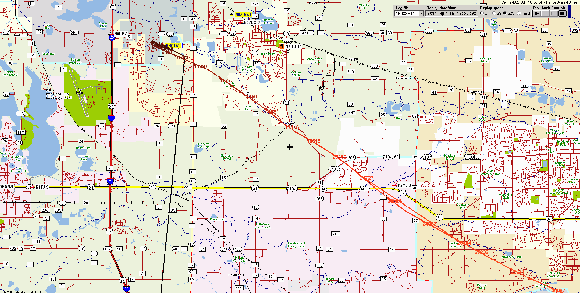
I assume the elbow at the right is a bogus posit before the GPS fully locked
and settled