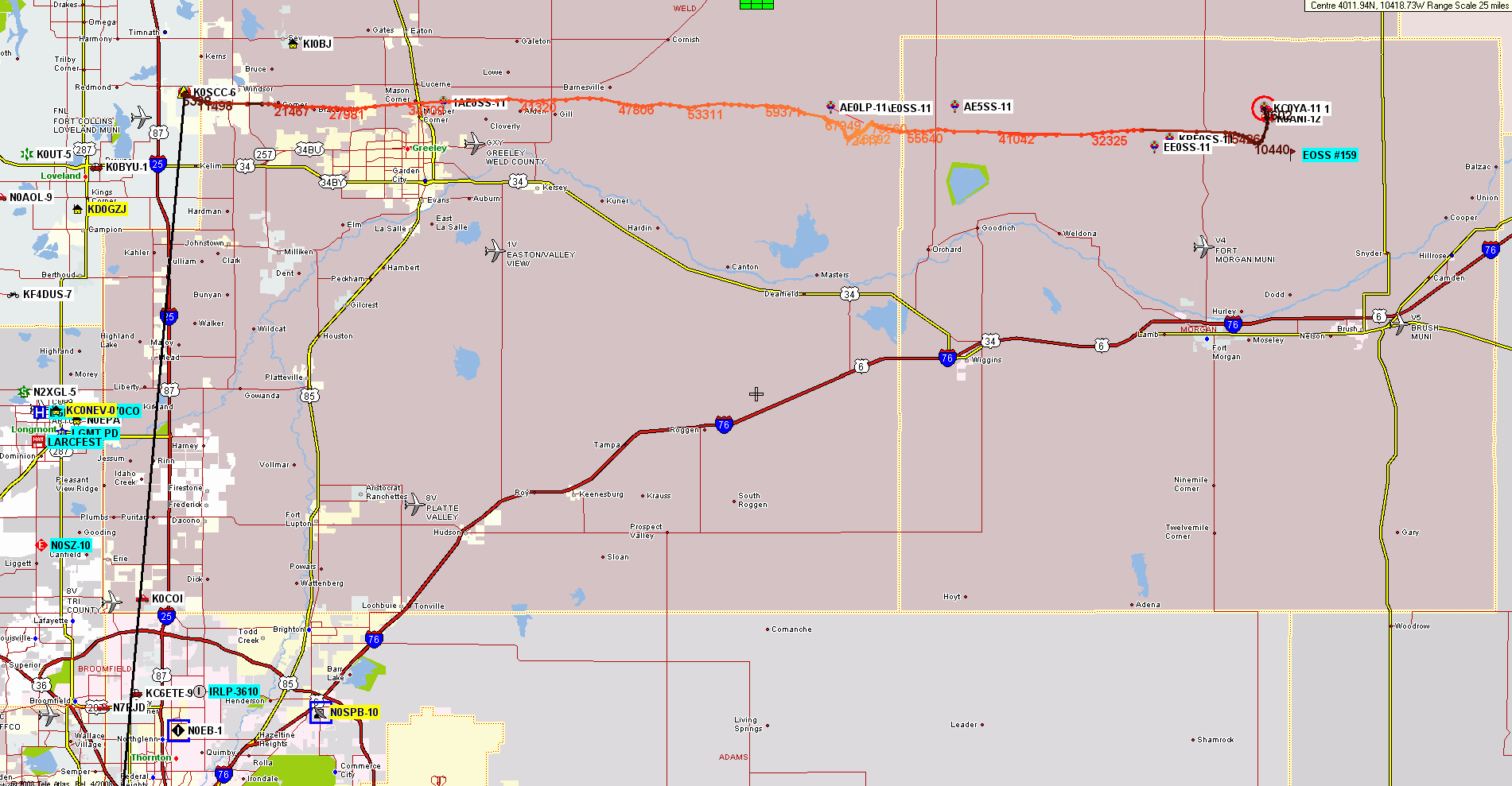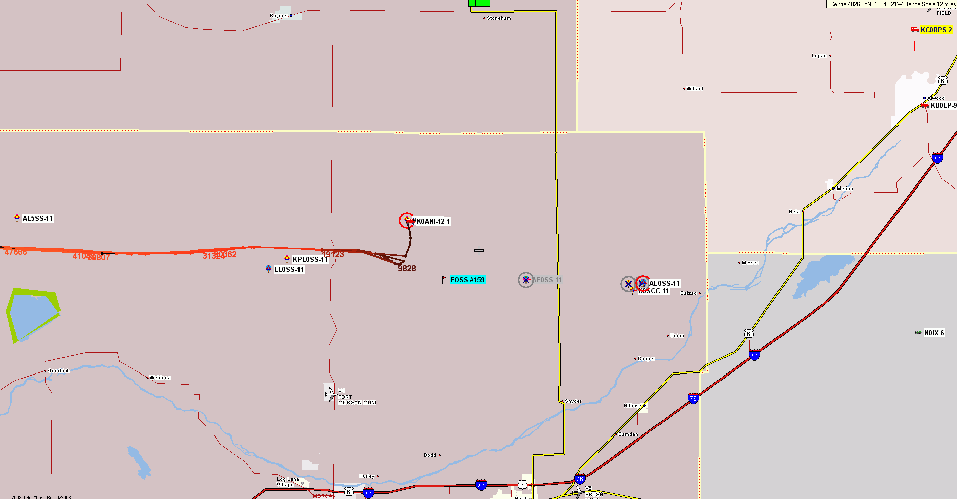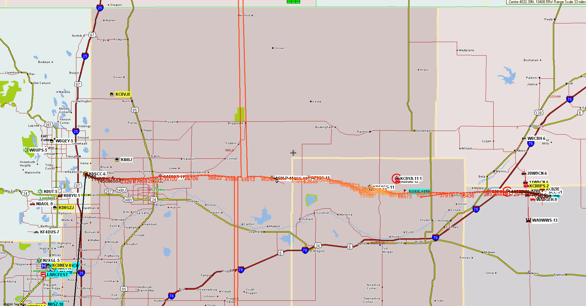
EOSS (Edge Of Space Sciences) Double Launch in ColoradoAE0SS-11 & KC0YA-11Saturday
12 March 2011 6:50/7:20 AM Local (Mountain) Time
|
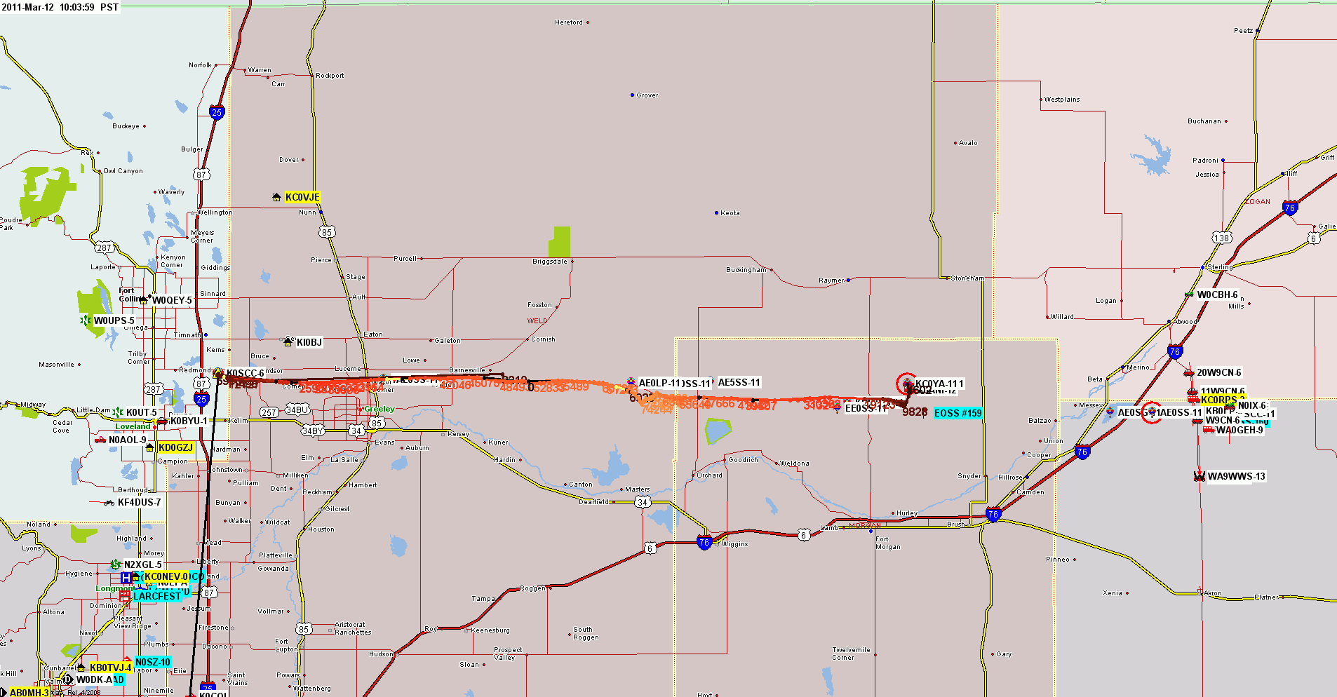
These are large (1920 x 1080 Full HD) screen captures from UIview and Delorme's TopoUSA 8.0. Many browsers will try to downsize these images to fit your screen, making the map details and labels an illegible blur, if your computer's display is less than 1920 x 1080 HD resolution.
Most modern browers can be toggled to display the image full size by clicking in the image area, or by choosing an image resize option from a pull-down menu. You will then get a clear display, but only part of the map will show. Scroll down and to the right to see all areas of both maps.
The actual downlink for APRS data from the balloons to the ground was on a private channel that was then retransmitted on the usual 144.39 frequency to find it's way to igates and the APRS-IS. (APRS Internet System).
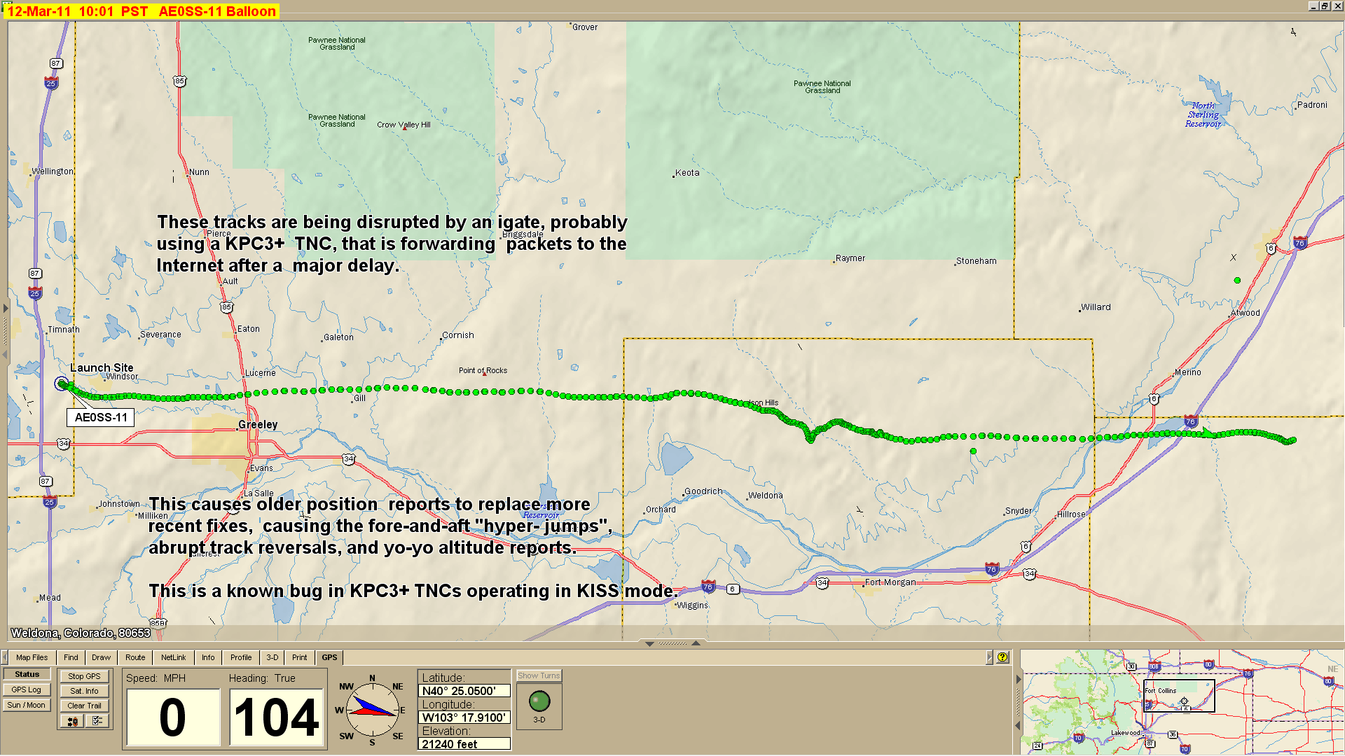
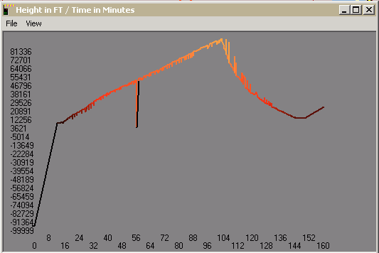
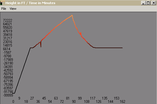
Tracking of these launches were marred by severely-delayed packets being injected into the APRS-IS. This causes more recently reported data to be superseded by older data. The result is tracks that "hyper-jump" forward-backward-forward-backward. In the case of aerial vehicles like balloons, successive reports also bounce up and down in altitude.
Delays in passing packets from the TNC to the attached computer is a known bug in KPC3+ TNCs operated in KISS mode (i.e.connected to a computer). The problem appears randomly after several days or weeks of operation, and can be cleared by issuing the RESET command to the TNC or by cycling it's power OFF and then back ON. This problem primarily affects home digi/igate stations, since they typically use a computer-based setup. It does not affect KPC3+ TNCs operating in stand-alone mode, as would be the case with most remotely located digipeaters.
Further, these launches were marred by one or more TNCs at digipeater or igate sites operating in PASSALL mode (a.k.a. "junque" mode). Numerous posits with impossible values were passed including elevations hundreds of feet below sea level, wild hyper-jumps 100s of miles at right-angles to the track path, and multiple corrupted versions of the two balloons' callsigns.
The tracks were further confused by the balloon trackers apparently being powered up (for a test??) on the south side of the Denver metro area, before being taken to the launch site. Or were beacons sent at the launch site before the GPS receivers achieved lock??
|
AE0SS-11 |
KC0YA-11 |
|
|
|
|